


Kerry county 1:100.000 mapa (Irsko)
mapa na syntetickém papíře
Popis:
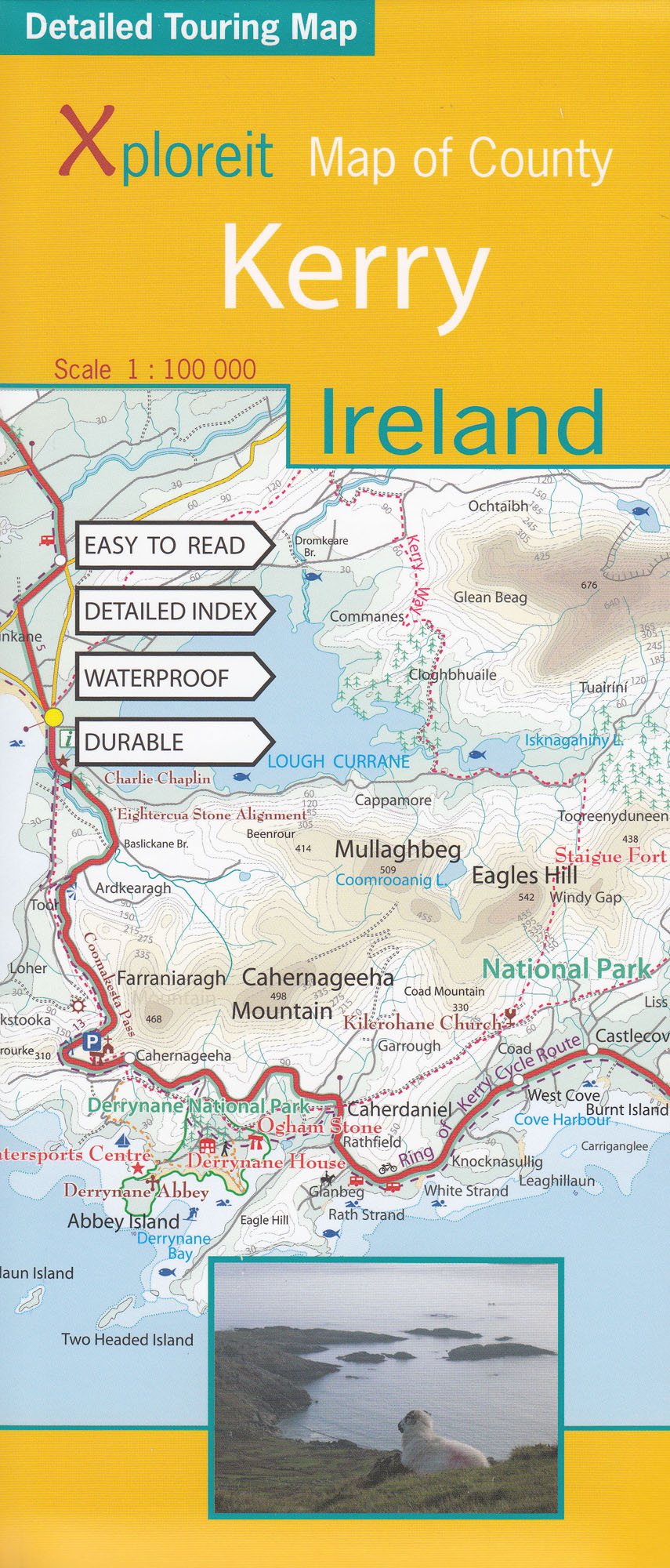
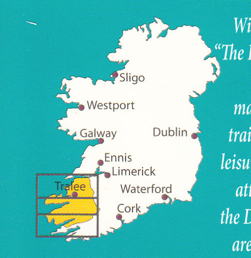
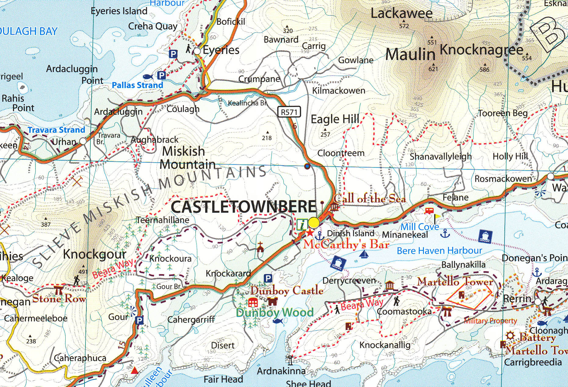
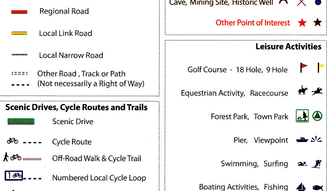
The Xploreit Map of County Kerry includes all of the 'Kingdom' of Kerry along with parts of counties Clare, Limerick and a large part of County Cork. Famous tourist destinations such as Killarney National Park, the Dingle Peninsula, the Skellig Islands (a UNESCO listed World Heritage Site), Derrynane House and the 'Ring of Kerry' scenic route are all shown on one double-sided map sheet. It illustrates a magical landscape of mountains, lakes, woodlands, rivers and streams bordered by a rugged atlantic coastline which is the longest of any county in Ireland. Golf courses, angling locations, beaches for swimming and surfing, historic sites, tourist centres and a host of other points of interest are clearly identified making this map an invaluable tool for both visitors and locals alike. Several scenic drives, cycle routes and waymarked walks are shown. The scale of the Kerry map is 1:100,000.
Potřebujete poradit?
Mohlo by Vás zajímat
 1:700t. mapa Borch")
 průvodce 2nd 2012 Lonely Planet")


")

")


