
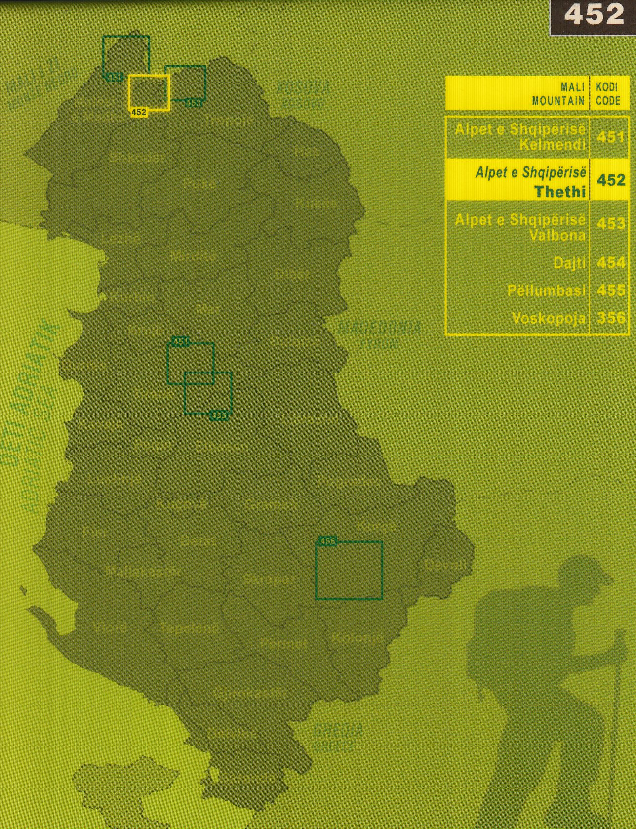
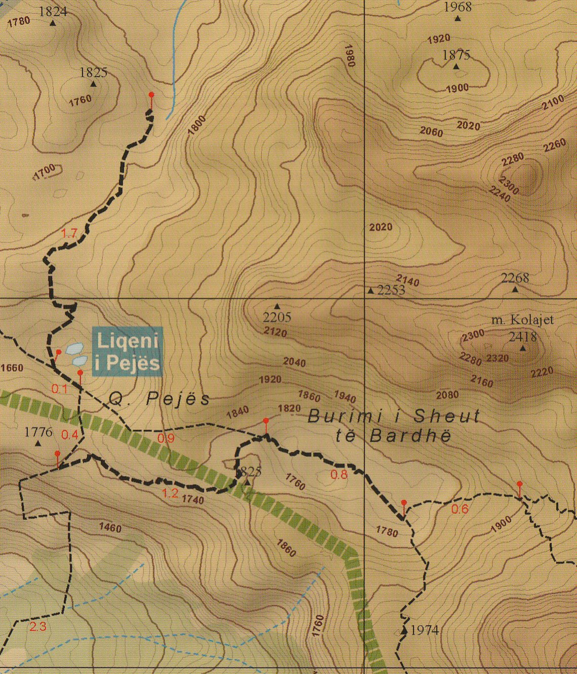
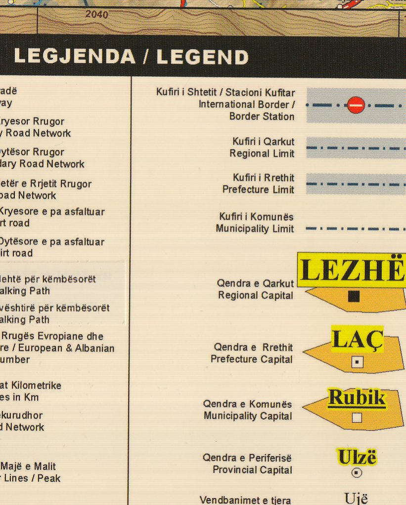
The map covers the Thethi National Park in northern Albania at 1:30,000, extending to Kelmendi range. The map is GPS compatible, contoured at 20m intervals, with spot heights, graphic relief for exposed rocky areas and colouring showing woodlands. Roads, including dirt tracks are shown as well as hiking trails (easy / difficult). Map symbols indicate camp sites, ski areas, churches, monasteries, castles, archaelogical remains, etc.
Latitude and longitude lines are drawn at 1' intervals. Added is an inset overview map of the northern tip of Albania, showing a larger area with access roads to the National Park. Map legend is in Albanian and English. Sheet size 68 x 48 cm / 27" x 19", one-sided lamination. The map is made in Albania.


Theti (Albánie) 1:30t turistická mapa VEKTOR
Popis:
Potřebujete poradit?
Mohlo by Vás zajímat
 mapa 1:200t VEKTOR")
 Vermoshi – Tamare – Razma – Thethi")
 1:10t plán města VEKTOR")
 automapa 1:350t VEKTOR")
 Shkodra")
 Tropoja – B. Curri – Valbona")

 Saranda")


